The High-Altitude Stronghold
From Tredegar town to the exposed moors of Trefil.
1. Wind Assessment
We check real-time wind shear. Trefil’s exposure demands Enterprise-grade stability.
2. Arrive & Pay
Accept the quote to book. To prevent fraud, payment is only taken upon arrival once flight safety is confirmed.
3. The Storm-Proof Scan
We use DJI Enterprise Matrice 3D to scan every slate in high-wind conditions. Ideal for exposed moorland properties.
4. Receive Data Package
You receive a PDF Condition Report and a link to every raw image & 4K video to show your insurer or roofer.
The "Storm-Proof" Guarantee
Trefil’s wind speeds often exceed 35 mph. If we cannot safely fly due to wind, you do not pay a penny.
*Disclaimer: Rescheduled visits are billed at the original quoted rate.
STORM-PROOF SURVEYS
When hobbyists abort, we operate.
Trefil sits at 1,200ft with constant wind shear. Consumer drones lose stability and drift into valleys.
We deploy DJI Enterprise Matrice 3D with advanced wind compensation algorithms, enabling stable flight where others cannot:
- ✅ High-Wind Certified: Operates safely in 45+ mph gusts.
- ✅ Thermal Stability: No drift from moorland updrafts.
- ✅ CAA A2 CofC Authorised: Legally compliant for high-risk zones.
Tredegar: Built for Weather That Still Wins
The Sirhowy valley head, Trefil and Bedwellty take the hardest wind in Blaenau Gwent.
Wind That Works a Roof Loose
Tredegar and Trefil sit on high open ground where wind arrives with nothing to slow it. The damage is cumulative rather than dramatic: nail heads fatigue, laps open a few millimetres a season, ridge mortar cracks and lets the tile rock. By the time it shows from the street, several winters of it have already happened.
Trefil Altitude and Freeze-Thaw
Trefil is the highest village in Wales, and roofs up there cross freezing point far more often than anything on the valley floor. Water in a hairline crack turns to ice, opens the crack, and repeats. Slate delaminates, mortar spalls, and pointing that looked adequate in October has failed by March.
Bedwellty and Sirhowy Terraces
The ranks through Bedwellty and Sirhowy are stepped into the hillside, with rear elevations effectively unreachable without a scaffold founded on a slope. Those are the elevations facing the weather. A twenty-minute flight from the front street records all of them.
A Fee That Does Not Depend on Bad News
CalonTerra does not repair roofs, so we gain nothing from finding a problem in Tredegar and lose nothing from finding none. You pay the same fixed fee either way and receive every image, the 4K video and a written condition report to use as you see fit.
Owning a Moorland Home in Trefil?
"The drone company couldn't fly — too windy."
Standard operators use consumer drones that fail in high wind. Our Enterprise system is built for Wales’ most exposed properties.
The Solution: Aerial evidence when others are grounded.
Insurance & Storm Damage
Insurers demand proof of *recent* storm damage on high-altitude properties.
- ✅ HD Evidence: 4K photos of fresh tile breaks.
- ✅ Date-Stamped Data: Proof for your claim.
- ✅ Independent Validation: Unbiased reports.
Typical Defects We Expose
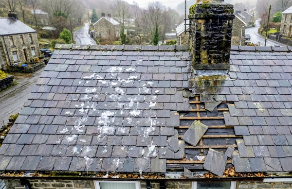
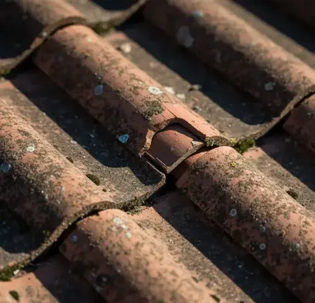
Wind-Lifted Slates
Identify slates peeled by gales. Critical for Trace and Access in exposed zones.
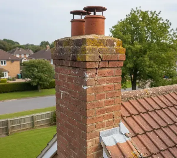
Chimney Stack Erosion
Check mortar pointing and chimney pots—failure points in high winds.
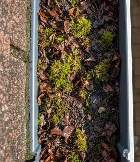
Vegetation Blockages
Moorland moss and grass clog gutters, causing overflow into eaves.
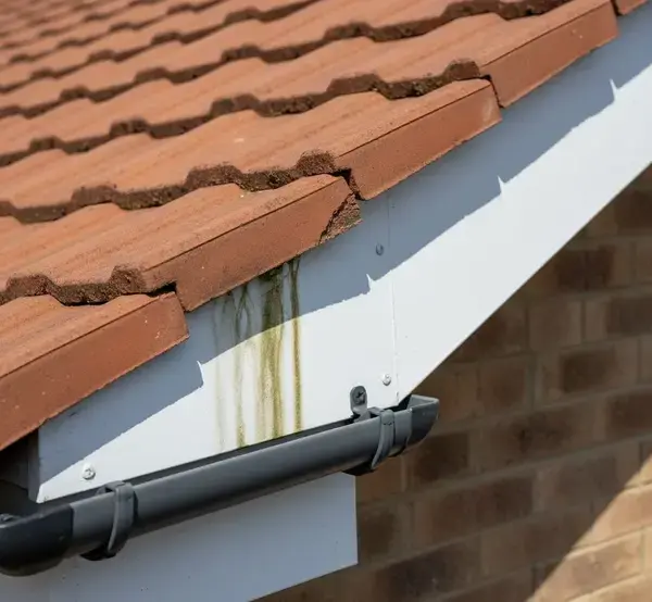
Timber Soffit Rot
Prolonged damp from driving rain in exposed locations.
Tredegar High-Altitude Intelligence
Our drones are calibrated to spot specific defects common to the moorland:
- Trefil Exposure: Wind-lifted slates on 1,200ft properties
- Sirhowy Terraces: Shared chimney party-wall disputes
- Pontsticill: Heritage stone tile delamination
- Rhymney Valley: Drainage failure on steep rear pitches
Tredegar Pricing
Includes high-wind surcharge (waived for NP22 postcodes).
Basic Check
£165*
"Is my chimney stable?"
- • 15 Minute Flight
- • Raw Images + Wind Report
*Standard rate £145 + £20 wind surcharge
Full Condition Report
£285*
Most Popular.
- • Full Roof & Chimney Scan
- • PDF Condition Report
- • Defect Highlighting
*Includes high-wind protocol
Heritage Stone Audit
From £345
Trefil & Pontsticill Heritage
- • Stone Tile Delamination
- • Conservation Officer Report
- • Party-Wall Documentation
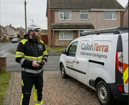
Pilot Certification & Insurance
Your assurance for a safe, compliant, and discreet survey.

CAA Operational Authorisation
UK CAA A2 Certificate of Competency (A2 CofC).
- ✅ Fully Insured: £5M Public Liability.
- ✅ High-Wind Certified: DJI Enterprise hardware for 45+ mph gusts
- ✅ GDPR Compliant: Data managed to strict ICO protocols.
NP22 High-Altitude Zones
Serving the most exposed housing in the UK.
- 📍 Tredegar Town
- 📍 Sirhowy Valley
- 📍 Trefil Moorland
- 📍 Pontsticill Reservoir
- 📍 Rhymney (Upper)
- 📍 Nantyglo Heights
High-Wind Materials
Book Your Tredegar Survey
Mention "Trefil" or "High-Wind" for priority scheduling.
Tredegar Drone Surveys: NP22 Questions
What Tredegar, Sirhowy, Trefil and Bedwellty residents ask.
It is always windy here. Will you actually be able to fly?
Usually, yes. We operate enterprise-grade airframes with substantially higher wind tolerance than consumer drones, and we plan slots around the forecast for the valley head rather than the coast. If conditions beat us on the day, you pay nothing and we rebook at the original quote.
What does wind damage look like on the images?
Slates crept out of line rather than missing outright, bright unweathered edges where a tile has fractured recently, ridge mortar cracked along its length, and lifted verges. Those are the early signs, and they are only visible from above at zoom.
Do you get up to Trefil and the quarry road?
Yes. Trefil, Sirhowy, Bedwellty and Georgetown all sit inside normal coverage from our Pontypool base, and the upland properties are precisely where a survey earns its money, because access on foot is so poor.
Can you provide evidence for a storm damage claim?
It is a large share of the work here. Insurers routinely argue that valley-head damage is wear and tear. Dated, high-resolution imagery from an independent surveyor showing fresh fracture faces and recent displacement is the most effective answer to that.
How does pricing work for NP22?
The survey fee plus travel from our NP4 base is calculated for your postcode in the form on this page, so you approve the full figure before booking. Payment is taken on arrival once the flight is confirmed safe to proceed.