The "Context" Layer
Why Architects use our drone data for preliminary planning.
1. Rapid Context
Stop designing in a void. We capture the entire site context—vegetation, slopes, and neighbouring structures—in a single flight. Import the .LAZ Point Cloud directly into Revit to see your design in situ.
2. Volumetric Estimations
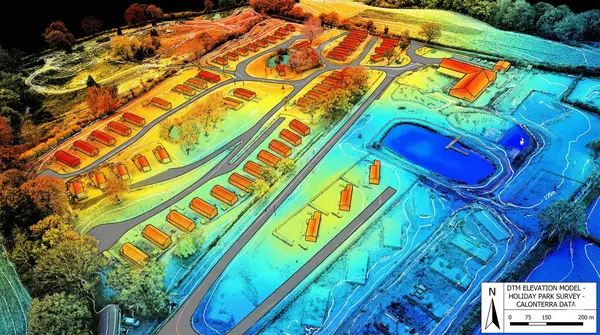
Need to calculate cut-and-fill? Our high-resolution photogrammetry models provide excellent relative accuracy for stockpile volume estimation and earthworks planning.
3. Visual Records
A timestamped "Digital Twin" of the site condition before contractors arrive. Invaluable for dispute resolution and proving site boundaries were respected.
Our Acquisition Hardware
Mavic 3 Pro (Hasselblad Edition)
We utilize flagship 4/3 CMOS optics to capture 20MP raw imagery with exceptional dynamic range. This allows us to reconstruct site geometry with high visual fidelity.
Deliverable Formats
A Note on Accuracy
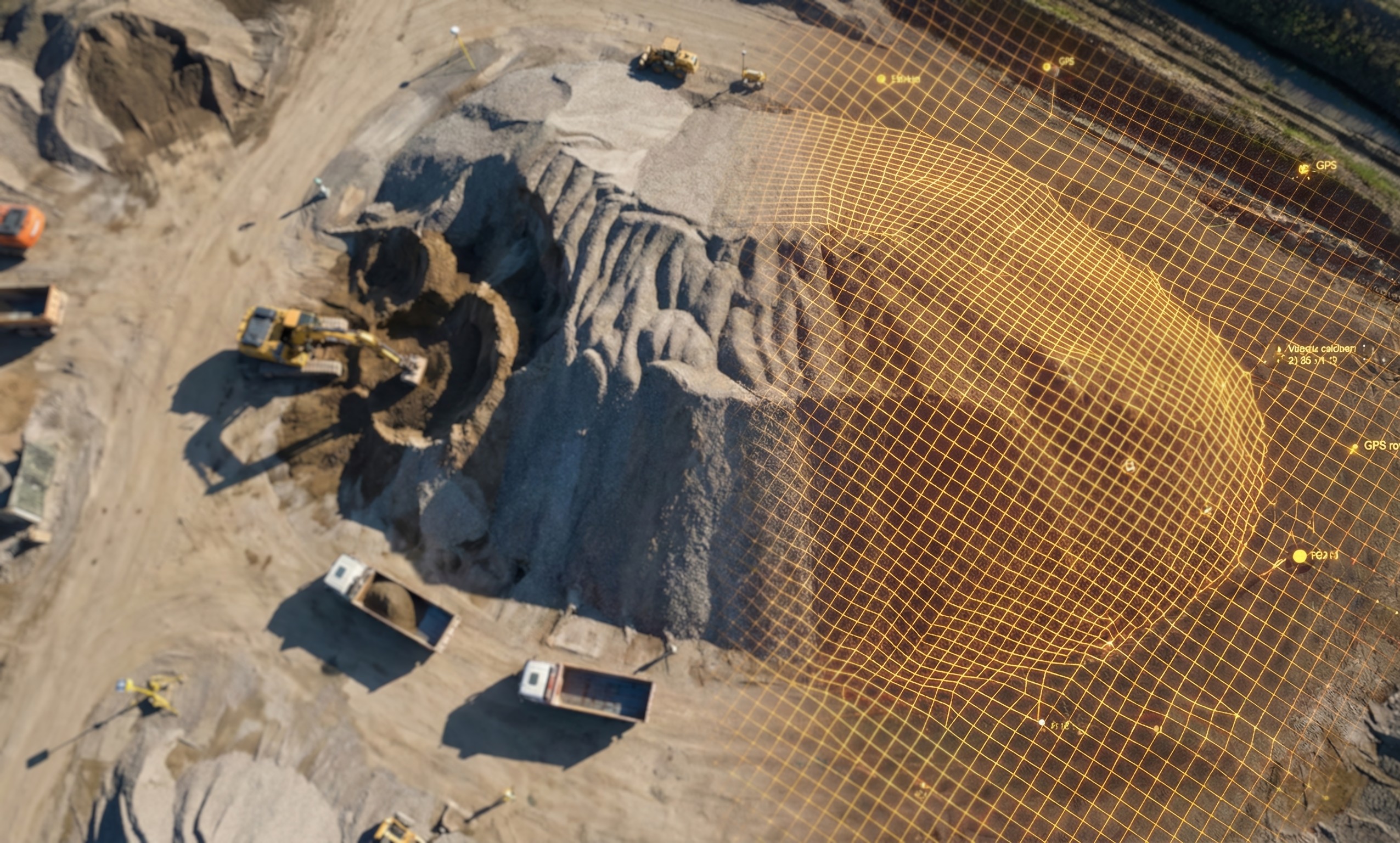
Current Standard: We utilize high-density photogrammetry. While excellent for relative measurements (volumes, distances within the site) and visual context, absolute global positioning (GPS coordinates) relies on standard satellite GNSS unless Ground Control Points (GCPs) are deployed.
Coming Late 2026: We are upgrading to RTK (Real-Time Kinematic) systems for millimetre-grade georeferencing.
From Flight to File
Seamless integration into your CAD/BIM workflow.
1. Planning
We map the flight grid based on your GSD (Ground Sampling Distance) requirements.
2. Capture
The Mavic 3 Pro executes an automated grid flight, capturing nadir and oblique imagery.
3. Processing
We generate the dense point cloud and filter out noise (cars, equipment) where possible.
4. Delivery
You receive a secure cloud link to download your assets directly into AutoCAD/Revit.
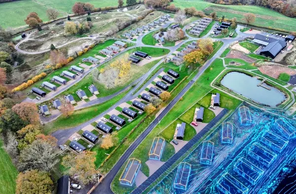
Sample Outputs
Data Assurance Statement
Clarification of Scope: CalonTerra provides "Visual & Digital Terrain Data." We are not Chartered Land Surveyors.
Our data is intended for Planning, Feasibility, and Visualisation. For legal boundary disputes or final construction setting-out, we recommend verifying specific critical points with a total station.
Get Topographical Rates
Upload your site boundary or describe the area.